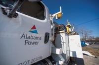
Alabama Power customers might be due for a refund next fall.
On Tuesday, the Alabama Public Service Commission (APSC) ruled that year-end financial results for the Alabama Power Company exceeded the rate of return range in 2022 by $62 million.
This is in spite of three rate hikes issued by the power company last year. In December, representatives from Alabama Power said the rate increases were necessary due to unprecedented inflation and poor economic conditions.
A spokesperson from the APSC told 1819 News that Alabama Power would issue refunds to customers through their August 2023 bills. This way, customers will receive refunds when bills are higher due to warmer weather.
Alabama Power will only issue refunds to customers who consumed power last July, August and September.
The exact dollar amount each customer will see is still being calculated and will not be made available for several days.
1819 News asked the spokesperson to specify whether or not Alabama Power's expected rate of return was impacted by the utility company's recent rate hikes. The spokesperson said that the APSC had no further comment.
Keep it Clean. Please avoid obscene, vulgar, lewd,
racist or sexually-oriented language. PLEASE TURN OFF YOUR CAPS LOCK. Don't Threaten. Threats of harming another
person will not be tolerated. Be Truthful. Don't knowingly lie about anyone
or anything. Be Nice. No racism, sexism or any sort of -ism
that is degrading to another person. Be Proactive. Use the 'Report' link on
each comment to let us know of abusive posts. Share with Us. We'd love to hear eyewitness
accounts, the history behind an article.
...EXTREME COLD WARNING NOW IN EFFECT FROM MIDNIGHT TONIGHT TO NOON
CST SUNDAY...
...WIND ADVISORY IN EFFECT FROM 2 AM TO 9 PM CST SATURDAY...


* WHAT...For the Extreme Cold Warning, dangerously cold wind chills
below zero are expected. For the Wind Advisory, northwest winds 15
to 25 mph with gusts up to 40 mph expected.

* WHERE...Autauga, Bibb, Blount, Chilton, Dallas, Etowah, Fayette,
Greene, Hale, Jefferson, Lamar, Lowndes, Marengo, Marion, Perry,
Pickens, Shelby, St. Clair, Sumter, Tuscaloosa, Walker, and
Winston Counties.

* WHEN...For the Extreme Cold Warning, from midnight tonight to noon
CST Sunday. For the Wind Advisory, from 2 AM to 9 PM CST Saturday.

* IMPACTS...Gusty winds will blow around unsecured objects. Trees
could be blown down and a few power outages may result. Frostbite
and hypothermia will occur if unprotected skin is exposed to these
temperatures. An extended period of subfreezing temperatures could
cause pipes to burst.

PRECAUTIONARY/PREPAREDNESS ACTIONS...

Winds this strong can make driving difficult, especially for high
profile vehicles. Use extra caution.

Secure outdoor objects.

Dress in layers including a hat, face mask, and gloves if you must
go outside.

Keep pets indoors as much as possible.

Make frequent checks on older family, friends, and neighbors. Ensure
portable heaters are used correctly. Do not use generators or grills
inside.

To prevent freezing and possible bursting of pipes they should be
wrapped, drained, or allowed to drip slowly.

&&
Currently in Selma
53°
Mostly Cloudy
53° / 29°
1 PM
54°
2 PM
54°
3 PM
54°
4 PM
53°
5 PM
51°
Get Black Belt News headlines for free in your inbox every day!
Success! An email has been sent to with a link to confirm list signup.
Error! There was an error processing your request.


(0) comments
Welcome to the discussion.
Log In
Keep it Clean. Please avoid obscene, vulgar, lewd, racist or sexually-oriented language.
PLEASE TURN OFF YOUR CAPS LOCK.
Don't Threaten. Threats of harming another person will not be tolerated.
Be Truthful. Don't knowingly lie about anyone or anything.
Be Nice. No racism, sexism or any sort of -ism that is degrading to another person.
Be Proactive. Use the 'Report' link on each comment to let us know of abusive posts.
Share with Us. We'd love to hear eyewitness accounts, the history behind an article.