Hurricane Isaias could make landfall on the U.S. Gulf Coast this weekend, hours before No. 2 Georgia plays at No. 6 Alabama in a major college football game on Saturday night that President Donald Trump is planning to attend.
Weather Alert
This product covers Central Alabama **TROPICAL STORM WARNINGS ISSUED FOR SOUTHERN PORTIONS OF CENTRAL ALABAMA** NEW INFORMATION --------------- * CHANGES TO WATCHES AND WARNINGS: - The Tropical Storm Watch has been upgraded to a Tropical Storm Warning for Autauga, Barbour, Bullock, Dallas, Elmore, Lowndes, Macon, Marengo, Montgomery, and Pike * CURRENT WATCHES AND WARNINGS: - A Tropical Storm Warning is in effect for Autauga, Barbour, Bullock, Dallas, Elmore, Lowndes, Macon, Marengo, Montgomery, and Pike - A Tropical Storm Watch is in effect for Bibb, Chambers, Chilton, Clay, Coosa, Greene, Hale, Jefferson, Lee, Perry, Pickens, Randolph, Russell, Shelby, St. Clair, Sumter, Talladega, Tallapoosa, and Tuscaloosa * STORM INFORMATION: - About 650 miles south-southwest of Birmingham AL or about 580 miles south-southwest of Montgomery AL - 24.4N 89.3W - Storm Intensity 100 mph - Movement Northeast or 50 degrees at 12 mph SITUATION OVERVIEW ------------------ Hurricane Isaias will continue to move towards the Northern Gulf Coast, making landfall Friday evening. Winds will gust as high as 40 to 50 mph late Friday night through Saturday, with the potential for isolated higher gusts to 60 mph, resulting in the potential for numerous downed trees and power lines. All of Central Alabama is under Tropical Storm or High Wind watches and warnings. Rainfall amounts of 1.5 to 4 inches with locally higher amounts up to 5 inches will result in the potential for flash flooding, especially in urban and other poor drainage areas. A threat for isolated tornadoes may develop across portions of Central Alabama along and east of the track on Saturday, mainly east of Interstate 65. Confidence is low to medium at this time. POTENTIAL IMPACTS ----------------- * WIND: Protect against dangerous wind having possible significant impacts across southern portions of Central Alabama and higher elevations. Potential impacts in this area include: - Some damage to roofing and siding materials, along with damage to porches, awnings, carports, and sheds. A few buildings experiencing window, door, and garage door failures. Mobile and manufactured homes damaged, especially if unanchored. Unsecured lightweight objects become dangerous projectiles. - Several large trees snapped or uprooted. Several fences and roadway signs blown over. - Some roads impassable from large debris, and more within urban or heavily wooded places. - Scattered power and communications outages, but more prevalent in areas with above ground lines. Also, protect against hazardous wind having possible limited impacts across the rest of Central Alabama. * FLOODING RAIN: Prepare for dangerous rainfall flooding having possible significant impacts across Central Alabama. Potential impacts include: - Moderate rainfall flooding may prompt several evacuations and rescues. - Rivers and tributaries may quickly become swollen with swifter currents and overspill their banks in a few places, especially in usually vulnerable spots. Small streams, creeks, and ditches overflow. - Flood waters can enter some structures or weaken foundations. Several places may experience expanded areas of rapid inundation at underpasses, low-lying spots, and poor drainage areas. Some streets and parking lots take on moving water as storm drains and retention ponds overflow. Driving conditions become hazardous. Some road and bridge closures. * TORNADOES: Protect against a dangerous tornado event having possible significant impacts across eastern portions of Central Alabama. Potential impacts include: - Several places may experience tornado damage with a few spots of considerable damage, power loss, and communications failures. - Locations could realize roofs torn off frame houses, mobile and manufactured homes demolished, large trees snapped or uprooted, and vehicles tumbled. Dangerous projectiles can add to the toll. PRECAUTIONARY/PREPAREDNESS ACTIONS ---------------------------------- * EVACUATIONS: Follow the advice of local officials. * OTHER PREPAREDNESS INFORMATION: Now is the time to check your emergency plan and emergency supplies kit and take necessary actions to protect your family and secure your home or business. When making safety and preparedness decisions, do not focus on the exact forecast track since hazards such as flooding rain, damaging wind gusts, and tornadoes extend well away from the center of the storm. If in a place that is vulnerable to high wind, such as near large trees or in a mobile or manufactured home, plan to move to safe shelter. If you live in a place particularly vulnerable to flooding, such as in a low-lying or poor drainage area, in a valley, or near an already swollen river, plan to move to safe shelter on higher ground. Check on those who may not be fully aware of the situation or who are unable to make personal preparations. Closely monitor weather.gov, NOAA Weather Radio and local news outlets for official storm information. Listen for possible changes to the forecast. There is a threat from tornadoes with this storm. Have multiple ways to receive Tornado Warnings. Be ready to shelter quickly. * ADDITIONAL SOURCES OF INFORMATION: - For information on appropriate preparations see ready.gov - For information on creating an emergency plan see getagameplan.org - For additional disaster preparedness information see redcross.org NEXT UPDATE ----------- The next local statement will be issued by the National Weather Service in Birmingham AL around 10 PM CDT, or sooner if conditions warrant.
Weather Alert
...TROPICAL STORM WARNING IN EFFECT... A Tropical Storm Warning means tropical storm-force winds are expected somewhere within this area within the next 36 hours * LOCATIONS AFFECTED - Selma * WIND - LATEST LOCAL FORECAST: Equivalent Tropical Storm force wind - Peak Wind Forecast: 30-40 mph with gusts to 65 mph - Window for Tropical Storm force winds: Friday evening until Saturday afternoon - THREAT TO LIFE AND PROPERTY THAT INCLUDES TYPICAL FORECAST UNCERTAINTY IN TRACK, SIZE AND INTENSITY: Potential for wind 58 to 73 mph - The wind threat has increased from the previous assessment. - PLAN: Plan for dangerous wind of equivalent strong tropical storm force. - PREPARE: Remaining efforts to protect life and property should be completed as soon as possible. Prepare for significant wind damage. - ACT: Move to safe shelter before the wind becomes hazardous. - POTENTIAL IMPACTS: Significant - Some damage to roofing and siding materials, along with damage to porches, awnings, carports, and sheds. A few buildings experiencing window, door, and garage door failures. Mobile and manufactured homes damaged, especially if unanchored. Unsecured lightweight objects become dangerous projectiles. - Several large trees snapped or uprooted. Several fences and roadway signs blown over. - Some roads impassable from large debris, and more within urban or heavily wooded places. - Scattered power and communications outages, but more prevalent in areas with above ground lines. * FLOODING RAIN - LATEST LOCAL FORECAST: Flood Watch is in effect - Peak Rainfall Amounts: 2-4 inches, with locally higher amounts - THREAT TO LIFE AND PROPERTY THAT INCLUDES TYPICAL FORECAST UNCERTAINTY IN TRACK, SIZE AND INTENSITY: Potential for moderate flooding rain - The flooding rain threat has remained nearly steady from the previous assessment. - PLAN: Emergency plans should include the potential for moderate flooding from heavy rain. Evacuations and rescues are possible. - PREPARE: Consider protective actions if you are in an area vulnerable to flooding. - ACT: Heed any flood watches and warnings. Failure to take action may result in serious injury or loss of life. - POTENTIAL IMPACTS: Significant - Moderate rainfall flooding may prompt several evacuations and rescues. - Rivers and tributaries may quickly become swollen with swifter currents and overspill their banks in a few places, especially in usually vulnerable spots. Small streams, creeks, and ditches overflow. - Flood waters can enter some structures or weaken foundations. Several places may experience expanded areas of rapid inundation at underpasses, low-lying spots, and poor drainage areas. Some streets and parking lots take on moving water as storm drains and retention ponds overflow. Driving conditions become hazardous. Some road and bridge closures. * TORNADO - LATEST LOCAL FORECAST: - Situation is unfavorable for tornadoes - THREAT TO LIFE AND PROPERTY THAT INCLUDES TYPICAL FORECAST UNCERTAINTY IN TRACK, SIZE AND INTENSITY: Tornadoes not expected - The tornado threat has decreased from the previous assessment. - PLAN: Tornadoes are not expected. Showers and thunderstorms with gusty winds may still occur. - PREPARE: Little to no preparations needed to protect against tornadoes at this time. Keep informed of the latest tornado situation. - ACT: Listen for changes in the forecast. - POTENTIAL IMPACTS: Little to None - Little to no potential impacts from tornadoes. * FOR MORE INFORMATION: - http://ready.gov/hurricanes
Weather Alert
...FLOOD WATCH IN EFFECT FROM FRIDAY EVENING THROUGH SUNDAY MORNING... * WHAT...Flooding caused by excessive rainfall is possible. * WHERE...All of Central Alabama. * WHEN...From Friday evening through Sunday morning. * IMPACTS...Excessive runoff may result in flooding of rivers, creeks, streams, and other low-lying and flood-prone locations. * ADDITIONAL DETAILS... - Heavy rainfall associated with Hurricane Isaias will move into the area Friday night, and may last as long as early Sunday morning. Rainfall amounts of 2 to 4 inches with locally higher amounts up to 5 inches will result in the potential for flash flooding, especially in urban and other poor drainage areas. PRECAUTIONARY/PREPAREDNESS ACTIONS... You should monitor later forecasts and be alert for possible Flood Warnings. Those living in areas prone to flooding should be prepared to take action should flooding develop. &&
News
A suspect is being sought by police in connection with the shooting of a man in Montgomery in February 2021.
Alabama Secretary of State Wes Allen is reminding citizens that the deadline to send absentee ballot applications to county absentee election managers is Oct. 27 and to return them in person on Oct. 29.
State Health Officer Dr. Scott Harris urges Alabamians to heed all health and safety warnings as areas of the state prepare for the possibility of significant flooding and damage from Hurricane Isaias. Keep yourself and others safe by being aware of potential hazards and the protective actio…
Montgomery police are seeking two suspects of a shooting that took place on Sept. 2.
Two Black Belt students are among others to be part of the University of Alabama (UA) College of Community Health Sciences' Rural Programs.
The 48th Annual Kathryn Tucker Windham Tale Tellin’ Festival will take place on Oct. 15 and will be headlined by Megan Hicks.
- Updated
The Southern Environmental Law Center has outlined why it is suing two federal agencies over a methane gas pipeline that is being buried through the heart of the Black Belt.
Brad Fisher
Associate Publisher
Deputies from the Pickens County Sheriff's Office (PCSO) helped to locate a victim who had been kidnapped in nearby Tuscaloosa County.
As a teacher, coach, administrator, and now as executive director of the AHSAA, I have come to believe that every high school contest asks the adults in attendance a simple question: Are we he…
- Updated
For the first time in five tries, the Sipsey Valley High School Bears defeated the Demopolis High School Tigers in an offensive showcase that featured 13 touchdowns between the two teams.
Brad Fisher
Associate Publisher
- Updated
Southside High School got their second win of the season Friday night with a strong offensive performance against Sumter Central High and a big score of 56-6.
Local Events
The Craig Field Airport & Industrial Authority has appointed Myiesha Johnson as deputy director of airport operations and tenant leasing.
- Updated
The Montgomery Chamber of Commerce held a ribbon cutting last week for The Evening Clinics, founded by former Selma doctor Olusunmisola Oyesiku. Dr. O has a background in working in Selma.
- Updated
Craig Field Airport and Industrial Authority introduced Selma native James Thomas as its new executive director Tuesday afternoon, concluding a nationwide search that drew 23 applicants, including one from Hawaii.
The Montgomery Chamber of Commerce held a ribbon cutting last week for The Evening Clinics, founded by former Selma doctor Olusunmisola Oyesiku.
Cindy Fisher
Publisher
- Updated
As Hurricane Isaias approaches the Alabama coast, schools in the Black Belt are considering school schedules for Friday.
Cindy Fisher
Publisher
- Updated
Linden High School students moved into the newly built campus on Tuesday.
- Updated
The Alabama School of Healthcare Sciences has been awarded $7.27 million in federal grant funding to prepare students for healthcare careers and strengthen the workforce serving Alabama’s rural communities.
- Updated
Christmas on the River in Demopolis held their 2026 Miss COTR pageant on Saturday, Oct. 3.Kaitlyn Grace Allen was named Miss COTR 2026. First alternate is Julia Hall. Second alternate is Claire Hasty. Third is Sadie Drew Dixon. Fourth alternate is Emaleigh Blanton.Miss Junior COTR 2026 was h…
Cindy Fisher
Publisher
Famed published photographer and Selma native Jerry Siegel enjoyed a large turnout for his reception and show Sunday at the Selma Art Guild’s (SAG) Gallery.
- Updated
Dallas Academy in downtown Selma has sold to Tres and Helene Taylor, artists in Selma who want to turn the historic building into a haven for artists. The art team also is working with the city of Selma to house artists at closed Byrd School .
AUBURN UNIVERSITY, Ala. — Alabama row crop farmers are facing sharply higher harvest expenses as diesel prices climb well above the levels used to build 2026 production budgets.
A deer management and herd health seminar will be held by the Alabama Department of Conservation and Natural Resources (ADCN) in Livingston on Sept. 8.
With dove season opening Sept. 5, and deer bow season opening Oct. 15, hunters need to know about some changes to the way they purchase hunting licenses online.
Todd Prater
Reporter
Opinion
As a teacher, coach, administrator, and now as executive director of the AHSAA, I have come to believe that every high school contest asks the adults in attendance a simple question: Are we helping young people learn the right lessons, or are we allowing the pressure to win to teach the wrong ones?
Governor Kay Ivey’s term of office is soon coming to an end. And while her legacy will be that she was the longest continuously serving governor in state history, she can rightly point to the success of economic development while she led the state.
Jamie “Red” Etheredge turned 94 years old on June 15. He has been one of the most outstanding and kindhearted leaders our state has seen this century.
Obituaries
- Updated
The father of Selma Mayor Johnny Moss III has passed away.
- Updated
Lannie’s Bar-B-Que in Selma has announced the passing of owner Lula Hatcher.
- Updated
Funeral arrangements have been announced for civil rights leader Jo Ann Bland, who passed aw…
- Updated
Those who knew and loved civil rights leader Jo Ann Bland of Selma have been sharing outpour…
Weather Alert
This product covers Central Alabama **TROPICAL STORM WARNINGS ISSUED FOR SOUTHERN PORTIONS OF CENTRAL ALABAMA** NEW INFORMATION --------------- * CHANGES TO WATCHES AND WARNINGS: - The Tropical Storm Watch has been upgraded to a Tropical Storm Warning for Autauga, Barbour, Bullock, Dallas, Elmore, Lowndes, Macon, Marengo, Montgomery, and Pike * CURRENT WATCHES AND WARNINGS: - A Tropical Storm Warning is in effect for Autauga, Barbour, Bullock, Dallas, Elmore, Lowndes, Macon, Marengo, Montgomery, and Pike - A Tropical Storm Watch is in effect for Bibb, Chambers, Chilton, Clay, Coosa, Greene, Hale, Jefferson, Lee, Perry, Pickens, Randolph, Russell, Shelby, St. Clair, Sumter, Talladega, Tallapoosa, and Tuscaloosa * STORM INFORMATION: - About 650 miles south-southwest of Birmingham AL or about 580 miles south-southwest of Montgomery AL - 24.4N 89.3W - Storm Intensity 100 mph - Movement Northeast or 50 degrees at 12 mph SITUATION OVERVIEW ------------------ Hurricane Isaias will continue to move towards the Northern Gulf Coast, making landfall Friday evening. Winds will gust as high as 40 to 50 mph late Friday night through Saturday, with the potential for isolated higher gusts to 60 mph, resulting in the potential for numerous downed trees and power lines. All of Central Alabama is under Tropical Storm or High Wind watches and warnings. Rainfall amounts of 1.5 to 4 inches with locally higher amounts up to 5 inches will result in the potential for flash flooding, especially in urban and other poor drainage areas. A threat for isolated tornadoes may develop across portions of Central Alabama along and east of the track on Saturday, mainly east of Interstate 65. Confidence is low to medium at this time. POTENTIAL IMPACTS ----------------- * WIND: Protect against dangerous wind having possible significant impacts across southern portions of Central Alabama and higher elevations. Potential impacts in this area include: - Some damage to roofing and siding materials, along with damage to porches, awnings, carports, and sheds. A few buildings experiencing window, door, and garage door failures. Mobile and manufactured homes damaged, especially if unanchored. Unsecured lightweight objects become dangerous projectiles. - Several large trees snapped or uprooted. Several fences and roadway signs blown over. - Some roads impassable from large debris, and more within urban or heavily wooded places. - Scattered power and communications outages, but more prevalent in areas with above ground lines. Also, protect against hazardous wind having possible limited impacts across the rest of Central Alabama. * FLOODING RAIN: Prepare for dangerous rainfall flooding having possible significant impacts across Central Alabama. Potential impacts include: - Moderate rainfall flooding may prompt several evacuations and rescues. - Rivers and tributaries may quickly become swollen with swifter currents and overspill their banks in a few places, especially in usually vulnerable spots. Small streams, creeks, and ditches overflow. - Flood waters can enter some structures or weaken foundations. Several places may experience expanded areas of rapid inundation at underpasses, low-lying spots, and poor drainage areas. Some streets and parking lots take on moving water as storm drains and retention ponds overflow. Driving conditions become hazardous. Some road and bridge closures. * TORNADOES: Protect against a dangerous tornado event having possible significant impacts across eastern portions of Central Alabama. Potential impacts include: - Several places may experience tornado damage with a few spots of considerable damage, power loss, and communications failures. - Locations could realize roofs torn off frame houses, mobile and manufactured homes demolished, large trees snapped or uprooted, and vehicles tumbled. Dangerous projectiles can add to the toll. PRECAUTIONARY/PREPAREDNESS ACTIONS ---------------------------------- * EVACUATIONS: Follow the advice of local officials. * OTHER PREPAREDNESS INFORMATION: Now is the time to check your emergency plan and emergency supplies kit and take necessary actions to protect your family and secure your home or business. When making safety and preparedness decisions, do not focus on the exact forecast track since hazards such as flooding rain, damaging wind gusts, and tornadoes extend well away from the center of the storm. If in a place that is vulnerable to high wind, such as near large trees or in a mobile or manufactured home, plan to move to safe shelter. If you live in a place particularly vulnerable to flooding, such as in a low-lying or poor drainage area, in a valley, or near an already swollen river, plan to move to safe shelter on higher ground. Check on those who may not be fully aware of the situation or who are unable to make personal preparations. Closely monitor weather.gov, NOAA Weather Radio and local news outlets for official storm information. Listen for possible changes to the forecast. There is a threat from tornadoes with this storm. Have multiple ways to receive Tornado Warnings. Be ready to shelter quickly. * ADDITIONAL SOURCES OF INFORMATION: - For information on appropriate preparations see ready.gov - For information on creating an emergency plan see getagameplan.org - For additional disaster preparedness information see redcross.org NEXT UPDATE ----------- The next local statement will be issued by the National Weather Service in Birmingham AL around 10 PM CDT, or sooner if conditions warrant.
...TROPICAL STORM WARNING IN EFFECT... A Tropical Storm Warning means tropical storm-force winds are expected somewhere within this area within the next 36 hours * LOCATIONS AFFECTED - Selma * WIND - LATEST LOCAL FORECAST: Equivalent Tropical Storm force wind - Peak Wind Forecast: 30-40 mph with gusts to 65 mph - Window for Tropical Storm force winds: Friday evening until Saturday afternoon - THREAT TO LIFE AND PROPERTY THAT INCLUDES TYPICAL FORECAST UNCERTAINTY IN TRACK, SIZE AND INTENSITY: Potential for wind 58 to 73 mph - The wind threat has increased from the previous assessment. - PLAN: Plan for dangerous wind of equivalent strong tropical storm force. - PREPARE: Remaining efforts to protect life and property should be completed as soon as possible. Prepare for significant wind damage. - ACT: Move to safe shelter before the wind becomes hazardous. - POTENTIAL IMPACTS: Significant - Some damage to roofing and siding materials, along with damage to porches, awnings, carports, and sheds. A few buildings experiencing window, door, and garage door failures. Mobile and manufactured homes damaged, especially if unanchored. Unsecured lightweight objects become dangerous projectiles. - Several large trees snapped or uprooted. Several fences and roadway signs blown over. - Some roads impassable from large debris, and more within urban or heavily wooded places. - Scattered power and communications outages, but more prevalent in areas with above ground lines. * FLOODING RAIN - LATEST LOCAL FORECAST: Flood Watch is in effect - Peak Rainfall Amounts: 2-4 inches, with locally higher amounts - THREAT TO LIFE AND PROPERTY THAT INCLUDES TYPICAL FORECAST UNCERTAINTY IN TRACK, SIZE AND INTENSITY: Potential for moderate flooding rain - The flooding rain threat has remained nearly steady from the previous assessment. - PLAN: Emergency plans should include the potential for moderate flooding from heavy rain. Evacuations and rescues are possible. - PREPARE: Consider protective actions if you are in an area vulnerable to flooding. - ACT: Heed any flood watches and warnings. Failure to take action may result in serious injury or loss of life. - POTENTIAL IMPACTS: Significant - Moderate rainfall flooding may prompt several evacuations and rescues. - Rivers and tributaries may quickly become swollen with swifter currents and overspill their banks in a few places, especially in usually vulnerable spots. Small streams, creeks, and ditches overflow. - Flood waters can enter some structures or weaken foundations. Several places may experience expanded areas of rapid inundation at underpasses, low-lying spots, and poor drainage areas. Some streets and parking lots take on moving water as storm drains and retention ponds overflow. Driving conditions become hazardous. Some road and bridge closures. * TORNADO - LATEST LOCAL FORECAST: - Situation is unfavorable for tornadoes - THREAT TO LIFE AND PROPERTY THAT INCLUDES TYPICAL FORECAST UNCERTAINTY IN TRACK, SIZE AND INTENSITY: Tornadoes not expected - The tornado threat has decreased from the previous assessment. - PLAN: Tornadoes are not expected. Showers and thunderstorms with gusty winds may still occur. - PREPARE: Little to no preparations needed to protect against tornadoes at this time. Keep informed of the latest tornado situation. - ACT: Listen for changes in the forecast. - POTENTIAL IMPACTS: Little to None - Little to no potential impacts from tornadoes. * FOR MORE INFORMATION: - http://ready.gov/hurricanes
...FLOOD WATCH IN EFFECT FROM FRIDAY EVENING THROUGH SUNDAY MORNING... * WHAT...Flooding caused by excessive rainfall is possible. * WHERE...All of Central Alabama. * WHEN...From Friday evening through Sunday morning. * IMPACTS...Excessive runoff may result in flooding of rivers, creeks, streams, and other low-lying and flood-prone locations. * ADDITIONAL DETAILS... - Heavy rainfall associated with Hurricane Isaias will move into the area Friday night, and may last as long as early Sunday morning. Rainfall amounts of 2 to 4 inches with locally higher amounts up to 5 inches will result in the potential for flash flooding, especially in urban and other poor drainage areas. PRECAUTIONARY/PREPAREDNESS ACTIONS... You should monitor later forecasts and be alert for possible Flood Warnings. Those living in areas prone to flooding should be prepared to take action should flooding develop. &&
Currently in Selma
83°
Sunny
87° / 56°
5 PM
83°
6 PM
80°
7 PM
75°
8 PM
72°
9 PM
70°
- Updated
Sample ballots for the Nov. 3 general election are now available at the Alabama Secretary of State website. Read moreWatch: Sample ballots now available for general election
Sample ballots for the Nov. 3 general election are now available at the Alabama Secretary of State website. Read moreSample ballots now available for Nov. 3 general election
- Updated
Perry County voters going to the polls on Nov. 3 will see Donald Bennett Sr. as the Democratic option for the District 1 County Commission seat – not longtime incumbent Albert Turner Jr. Read moreWatch: Perry County ballot on Nov. 3 may surprise you
- Updated
Perry County voters going to the polls on Nov. 3 will see Donald Bennett Sr. as the Democratic option for the District 1 County Commission seat – not longtime incumbent Albert Turner Jr. Read morePerry County ballot has Bennett's name as Democratic nominee for District 1 Commission
- Updated
Albert Turner Jr. suffered another setback in his attempt to place his name on the ballot to keep his seat on the Perry County Commission. Read moreMontgomery judge denies Turner’s injunction in Perry County Commission ballot dispute
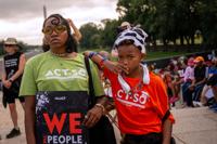
WASHINGTON (AP) — Thousands of protesters are rallying Friday on the National Mall in support of voting rights and racial justice ahead of the midterm elections, following a wave of changes to voting laws and redistricting that civil rights groups have condemned as detrimental to Black Americans. Read moreCivil rights groups make urgent plea for voting rights in DC, ahead of midterm elections
- Updated
The Alabama Democratic Executive Committee has overturned the Perry County Commission District 1 seat in a hearing Friday, putting incumbent Albert Turner Jr. in as the winner instead of challenger Donald Bennett. Read moreAlabama Democratic Party committee overturns Perry County District 1 result naming Turner winner
- Updated
The Alabama Democratic Party has set a contest hearing for Friday to again discuss the Perry County Commission District 1 primary election results. Read moreAlabama Democratic Party to hold another hearing Friday about Perry County Commission District 1 seat
- Updated
WASHINGTON — U.S. Rep. Shomari Figures and State Rep. Rhett Marques are in a statistical tie in the race for Alabama’s newly redrawn 2nd Congressional District, according to new polling from the House Democratic campaign arm. Read moreNew Democratic poll shows Figures and Marques in dead heat for AL-2 seat
- Updated
Democratic Rep. Shomari Figures will face a Republican endorsed by President Donald Trump in his fight for reelection to an Alabama congressional seat the GOP redrew as part of a larger effort to help the party keep control of the U.S. House. Read moreWatch: Alabama primary election results
National News
National Sports
National Entertainment
Local Events
Get Black Belt News headlines for free in your inbox every day!
Success! An email has been sent to with a link to confirm list signup.
Error! There was an error processing your request.
© Copyright 2026
Black Belt News Network
127A Broad Street,, Selma, AL
| Terms of Use
| Privacy Policy
Powered by BLOX Content Management System from BLOX Digital.