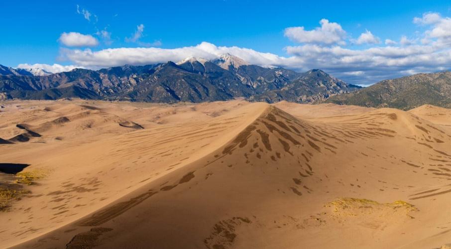
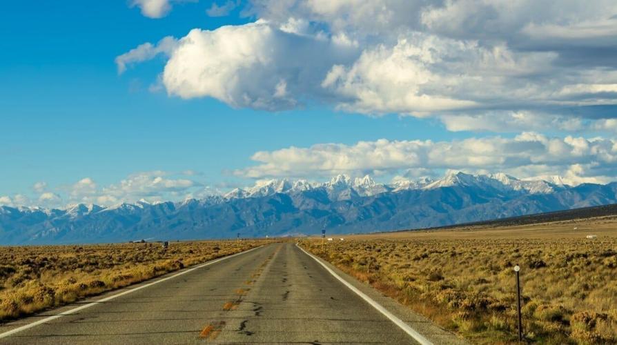
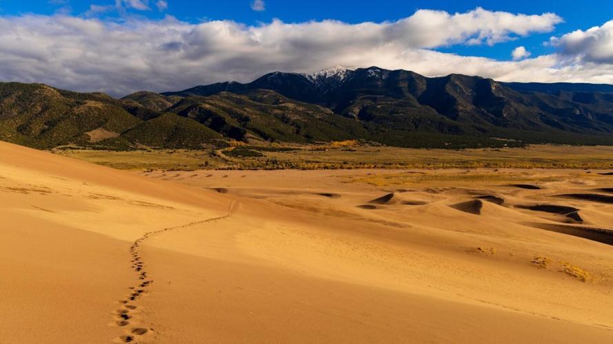
I was so excited for this five-day Colorado road trip. It would be my first time seeing Great Sand Dunes National Park and the San Luis Valley. The drive in was incredibly rainy, but I was optimistic it meant one thing: snow-capped peaks of the Sangre de Cristo Mountains above the dunes.
And oh boy, did Mother Nature deliver! The towering spires glistened in the sunlight as I drove into my 40th national park! Inside, you’ll get how I spent two days at the dunes, then spent the remaining three days adventuring north through Buena Vista, Twin Lakes, and Leadville.
I hope this gives you some fun ideas for your next Colorado road trip!
Why I Chose this Area for my October Colorado Road Trip
The Great Sand Dunes aren’t easy to reach from Denver, and after enjoying the mountains all summer, I figured October would be a great time for a Colorado road trip. Plus, since the sand looks the same year-round, I waited until Colorado’s fall colors were over before making the four-hour drive from Denver.
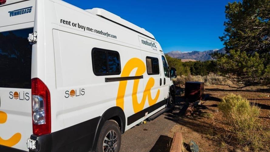
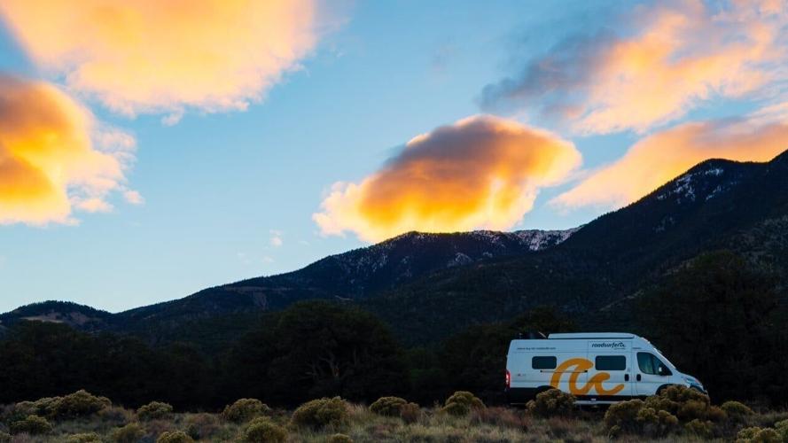
After this trip, I can attest that mid-October is a perfect time to hit the road, say, in a Roadsurfer camper van as I did, because crowds are sparse, temperatures and weather aren’t too bad, and you might even get lucky with snow-capped peaks above the dunes.
Can you do this Colorado Road Trip Itinerary Year Round?
Yes and no. Theoretically, yes, you can do this year-round. But I wouldn’t recommend this for winter. It’ll be very cold, and you’ll have snow on the ground for most of the trip. I recommend this route from May through October to maximize what you can do. Even though May might still have snow at higher elevations, days get longer, and hikes become much more accessible.
5-Day Colorado Road Trip in the San Luis Valley and Upper Arkansas River Valley

Photo Credit: Alec Sills-Trausch
One-minute itinerary breakdown
- Day 1 – Denver to Great Sand Dunes NP, some light hiking
- Day 2 – Great Sand Dunes all day
- Day 3 – Head up to BV/Twin Lakes + Hot Springs
- Day 4 – La Plata Peak or Independence Pass
- Day 5 – Leadville and head back to Denver
Day 1: Denver to Great Sand Dunes National Park
I grabbed the Roadsurfer from downtown Denver, loaded up my hiking and camera gear, and began the four-plus-hour drive southwest to North America’s tallest dunes. I had really cruddy weather on the way down, with lots of rain and clouds.
Thankfully, once I reached the western side of the Sangre de Cristo Mountains, the skies cleared, and the peaks towering above the dunes were snow-capped.
The views were picture-perfect!
Onto the Dunes

Photo Credit: Alec Sills-Trausch
That afternoon, I went straight to the dunes for sunset. It was a little windy, though nothing like the chaos the next day. It was nice to get my feet wet- err, sandy- in the park.
I didn’t get all the way up to High Dune because of time constraints, but I still hiked 1.5 miles round trip and climbed 500 feet into the dunes.
The views were nice, but because the sandy ridges are so high, you can’t get the expansive view you can at the Mesquite Sand Dunes in Death Valley National Park.
Pinon Flats Campground
After the sun had set, I pulled into Pinon Flats Campground. Being in a campervan was so nice, considering the lows were down into the upper 30s and the wind was picking up. The Roadsurfer’s stove, heater, refrigerator, and ample space were perfect.
I also pulled out my Dwarf 3 to photograph the night sky. Great Sand Dunes National Park is an internationally recognized Dark Sky Park. You can see the Milky Way with your naked eye, and the stars are so incredible.
Day 2: Explore Great Sand Dunes National Park
On my first morning in the park, I headed out to find the best compositions along the road. Thankfully, there are plenty of pullouts that can hold the camper van. With the recent snow, I wanted to get the peaks of the Crestones in the same frame as the dunes.
This meant driving 10-15 minutes from the campground and visitor center for the far-off peaks to finally emerge from behind the tall dunes.
I stopped at a few spots at first, but eventually found some beautiful shots as the sun hit the snow peaks and then rose high enough to hit the dunes.
Great Sand Dunes National Park Visitor Center

Photo Credit: Alec Sills-Trausch
After photographing sunrise, I ate breakfast in the van and looked out at the beautiful Sangre de Cristo Mountain Range. Then, I headed to the Visitor Center. It has lots of great information and a fantastic 20-minute video about the park, how it formed, and more. I highly recommend watching it when you visit.
Mosca Pass Trail
After learning about the park, I drove 2 minutes up the road to the Mosca Pass Trailhead. There, I grabbed my hiking gear, made a sandwich, and headed onto the trail.
This is a 7-mile round trip hike, though I only did about 3.2 miles. The first mile gains over half the trail’s elevation. As you climb, you get deeper into the narrow, rocky canyon.
I didn’t complete the hike because there’s only one view of the dunes, and the canyon’s interior was fine, but nothing special. I basically just wanted something to do until sunset, when I was to head out onto the sand again.
If you want to hike on a solid surface, this is a nice hike (and basically your only other option in the park). It does offer some nice fall colors if you visit in October, so keep that in mind!
Incredibly Windy Afternoon and Evening on the Dunes
I had such high hopes, and the wind wanted to play the role of villain. Once I arrived at the parking lot, I noticed the wind, but honestly had no idea what was possible just a hundred yards away.
The moment I stepped onto the sand and out from the tree protection, sand whipped around. But it was at my back, so I thought, ‘Well, this will make my ascent easier.’ (And it did… until I turned around.)
I just didn’t realize it would only get worse as the wind intensified. Each time I reached a higher dune, the wind threw more sand at me. It was pretty terrible. But as someone who apparently enjoys Type 2 fun, I pushed on to the final ridgeline that led to High Dune.
Here, though, I called it a day. I couldn’t see; I had sand in my right eye, in my mouth, and who knows where else.






What I didn’t realize was I had had it easy with the wind at my back. Now, I had to go downhill (easy) and straight into the wind (not easy). I also had a less-than-fully functioning right eye thanks to sand. All in all, I was not having a good time.
I moved as quickly as I could down the 1,000-foot descent (according to my watch, which is more than it should have been), across the sandy beach where Medano Creek would run on a spring day, and finally made it to the safe haven of my Roadsurfer.
After pouring at least a cup of sand from each shoe, shaking sand out of my jacket and clothes, and rinsing my eye, I finally let out a sigh of relief.
That evening, I headed back to the campground, photographed the fading light on the dunes, and enjoyed the warmth of the camper van as the wind shook it throughout the night.
Day 3: Buena Vista, Hot Springs, Cottonwood Pass, Twin Lakes

Photo Credit: Alec Sills-Trausch
When I opened the van’s door, the chilly morning air hit my face. Who needs coffee when 38-degree temperatures bite your face to wake you up? Instead of doing an extensive photoshoot, I walked to the north end of the campground and found a nice spot to shoot the sunrise.
The pink and orange hues colored the cloudless sky above the dunes. Eventually, the first light struck the top of Star Dune, then High Dune, and illuminated more and more of the sandy slopes and ridgelines. Soaking up the beauty of Great Sand Dunes National Park in near silence was a magical way to start the day.
Heading north
In a perfect world, I’d have hiked to nearby Zapata Falls. It’s only a mile round trip, but it would have required me to (probably) get my feet wet, and on this chilly morning, that didn’t seem ideal.
I headed into Alamosa (30 minutes away) to fill up the camper van’s water tank at the Maverik gas station and get breakfast. Locked and loaded, I began the 90-minute drive to the Mount Princeton Hot Springs south of Buena Vista.
Mount Princeton Hot Springs
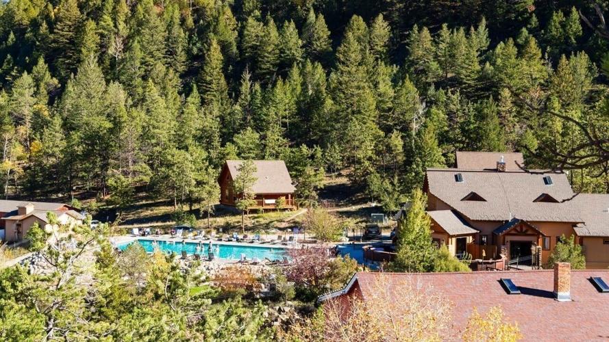
I’d never been before, but it came highly recommended, so I figured why not spend an afternoon relaxing. It’s $40 per person on weekdays and $45 on weekends. Somewhat pricey, but if you stay awhile, it’s worth it. And dang, the hot springs felt so nice on the chilly Friday afternoon.
There were quite a number of families with kids, but even the loud noises couldn’t ruin a peaceful soak in the mountains. It was my first time stopping in the region, and I really enjoyed it. Looking forward to coming back for a longer stay!
Cottonwood Pass
If you’re as adventurous as I am, there’s always room to see more. The drive up to Cottonwood Pass is absolutely beautiful, and it’s one of Colorado’s highest paved roads. Along the way, two nice hikes are Lost Lake and Ptarmigan Lake. Neither is too challenging, and both offer nice scenery.
You can also drive all the way up to 12,126 feet. At the pass, the 1.5-mile Cottonwood Pass Overlook trail lets you take in the area’s stunning peaks. It’s truly magnificent. This road tends to close in late October or early November, so keep an eye on current road conditions.
I planned to hike out to Lost Lake, but they closed the road to the trail parking lot, so I had nowhere to park and had to turn around. Instead, I found my way to Eddyline Brewery in Buena Vista for yummy pizza and a beer!
After dinner, I drove 30 minutes north to a campground at Twin Lakes to get an early start on a nearby 14er the following morning.
One of the best things about doing a Colorado road trip in a camper van is not having to set up and take down a tent each day. Plus, I could easily organize my food and gear for the next day’s summit attempt without freezing outside.
Day 4: 14ers and Independence Pass

Photo Credit: Alec Sills-Trausch
At 3:30am, my alarm went off.
I quickly heated water for coffee, made a quick breakfast, and finalized my pack. Around 4am, my buddy met me at the campground, and we headed to the La Plata Peak trailhead to tackle my first 14er since moving to Colorado. (I’ve done a handful of others in prior years such as Mount Sneffels, part of DeCaliBron, and Mount Whitney in California.)
La Plata Peak
This was a long, tiring day in the mountains. We started the 10-mile day at 4:30am. The first mile was pretty chill, a nice warm-up, but it also meant the 4,500 feet of elevation gain was pushed more and more to the back end of the hike.
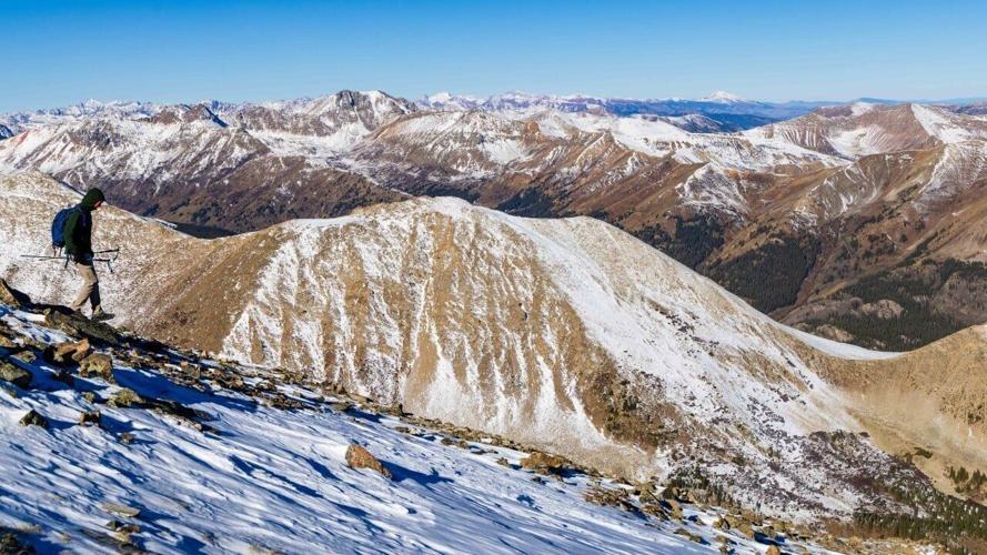
The trail hikes through the forest, and then starts switchbacking up a slope to reach a ridgeline that you then take all the way to the fifth-highest summit in Colorado. The switchbacks were where the snow began, but it wasn’t too bad because the trail was packed down.
It got hard and monotonous on the ridgeline as we had to gingerly pick our steps, navigating untouched snow and hoping we wouldn’t roll an ankle or twist a knee. So, each step was meticulous as we climbed higher and higher. At times, we rock-hopped because it was quicker and safer than stepping in snow.
After about four hours of hiking, we finally summited La Plata Peak under a cloudless, blue sky. It was stunning. Looking south, the slopes were snowy. And looking north, they were almost snow-free. Such a unique dynamic with north- vs. south-facing slopes.
The way down was slow, but we made it safely. By the end, we were so tired. Once back in the van, I didn’t move. I made some yummy meals, watched college football, and headed to bed early.
It was a fantastic day in the mountains!
Other Options around Independence Pass/Twin Lakes
Don’t want to summit a 14er? That’s totally fine! There’s a lot to do and see in this area.
Around Twin Lakes, I recommend the Interlaken Trail, South Mount Elbert Trail (the first few miles are mild), and Willis Gulch.
Further west near Independence Pass, you’ll find great trails such as North Fork Lake Creek Trail, Lost Man Lake, and the Independence Pass Ridgeline Trail. Once you go over, you’ll start getting into Aspen hikes and adventures.
Day 5: Final Adventures before coming back to Denver

Photo Credit: Alec Sills-Trausch
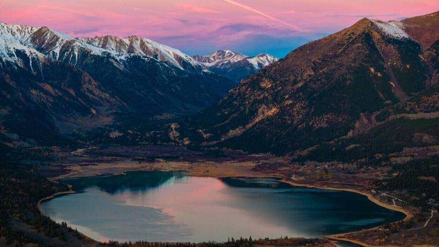
With later sunrises, I slept in before tossing the drone up for sunrise photos of Twin Lakes and the surrounding snow-capped peaks. This area has quickly grown on me and offers so much potential for exploration.
After packing up, I headed north 25 minutes to Leadville for breakfast and coffee at City on a Hill Coffee & Espresso. Their breakfast burrito and quiche were delicious, as was their coffee. I also snagged a freshly baked loaf of sourdough bread to bring home.
Nice Walk Around Clinton Reservoir
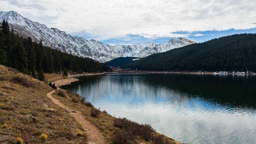
The stretch between Leadville and I-70 is a beautiful, less-visited region. You’ve got great hiking at Mayflower Gulch, plus Clinton Gulch Dam Reservoir. I’ve driven past it a half dozen times and finally stopped to enjoy it.
The trail is nearly flat, which was nice for my sore legs. While the parking lot was mostly full, the trail felt empty, letting me soak up the final stop on my Colorado road trip.
Overall, it’s a 2.5-mile, family-friendly walk around the water, though I just went out and back on the north side. If you have a Colorado fishing license, you can fish here.
This article first appeared on Explorewithalec.com. Click inside to see more images from the trip!
(0) comments
Welcome to the discussion.
Log In
Keep it Clean. Please avoid obscene, vulgar, lewd, racist or sexually-oriented language.
PLEASE TURN OFF YOUR CAPS LOCK.
Don't Threaten. Threats of harming another person will not be tolerated.
Be Truthful. Don't knowingly lie about anyone or anything.
Be Nice. No racism, sexism or any sort of -ism that is degrading to another person.
Be Proactive. Use the 'Report' link on each comment to let us know of abusive posts.
Share with Us. We'd love to hear eyewitness accounts, the history behind an article.