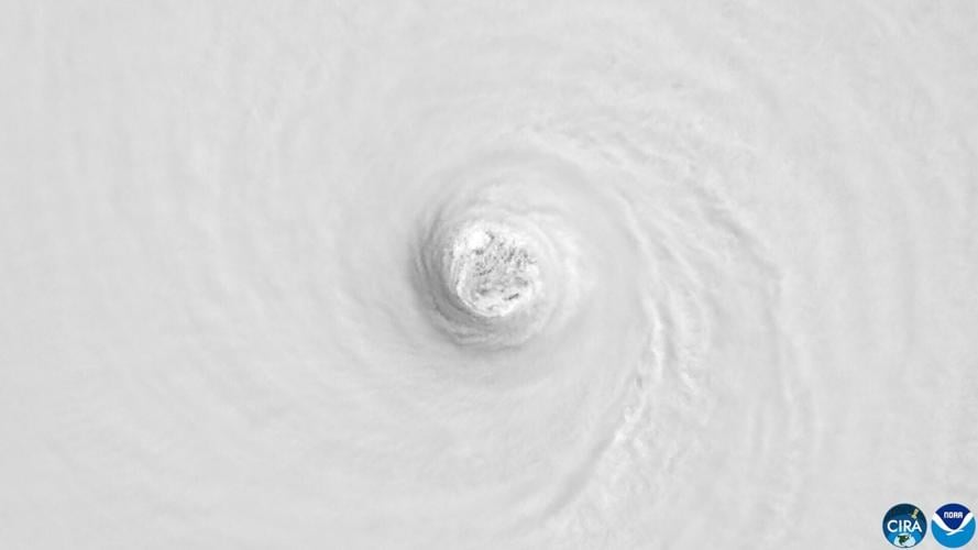
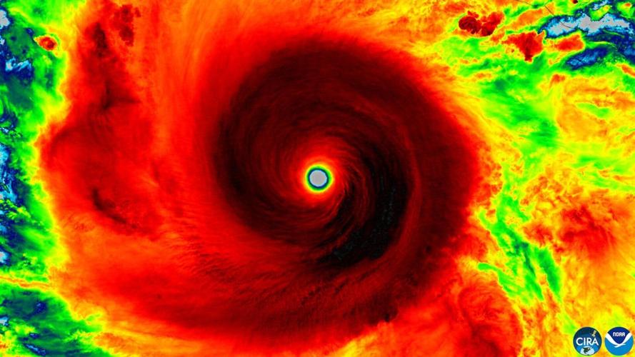
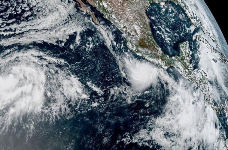

A NOAA satellite view of Hurricane Polo on Sept. 22. (NOAA via SWNS)
By Dean Murray
Incredible satellite observations show Hurricane Polo, one of the strongest storms ever recorded in the eastern Pacific.
The storm rapidly intensified off Mexico's southwestern coast Tuesday, reaching Category 5 winds of 180 mph and a central pressure of 892 millibars, according to the National Hurricane Center.

A NOAA satellite view of Hurricane Polo on Sept. 22. (NOAA via SWNS)






That made it the basin's second-most intense storm by that measure.
Only Hurricane Patricia, in 2015, was stronger, with a central pressure of 872 millibars and maximum sustained winds of 215 mph.

A NOAA satellite view of Hurricane Polo on Sept. 21. (NOAA via SWNS)
Polo weakened slightly to a Category 4 hurricane early Wednesday. It was about 160 miles south of Zihuatanejo, a resort city on Mexico's Pacific coast, Wednesday morning, with winds of 150 mph.
(0) comments
Welcome to the discussion.
Log In
Keep it Clean. Please avoid obscene, vulgar, lewd, racist or sexually-oriented language.
PLEASE TURN OFF YOUR CAPS LOCK.
Don't Threaten. Threats of harming another person will not be tolerated.
Be Truthful. Don't knowingly lie about anyone or anything.
Be Nice. No racism, sexism or any sort of -ism that is degrading to another person.
Be Proactive. Use the 'Report' link on each comment to let us know of abusive posts.
Share with Us. We'd love to hear eyewitness accounts, the history behind an article.