The eligibility hearing for former Missouri defensive tackle Sterling Webb has been pushed to Thursday. Webb was slated to have a hearing Wednesday morning regarding him suing the NCAA for an additional year of collegiate eligibility.
The eligibility hearing for former Missouri defensive tackle Sterling Webb has been pushed to Thursday. Webb was slated to have a hearing Wednesday morning regarding him suing the NCAA for an additional year of collegiate eligibility.

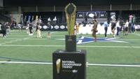
Big 12 Media Days kicked off at The Star in Frisco, spotlighting the conference’s offseason developments as the newly expanded 16-team Big 12 prepares for the upcoming football season. Key storylines emerged around coaching changes and team outlooks.

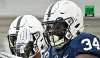
The 2026 college football season is edging ever closer, with Penn State opening against Marshall at Beaver Stadium on Saturday, September 5. When the Nittany Lions appear for the first time, the team will be very different from the one that w…

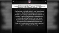
KERR COUNTY, Texas -- While rescue efforts are on-going for the devastating floods that hit central Texas, pro teams in the state are stepping up to help out.

FRISCO, Texas – A few weeks after Jerry Jones hinted at a "substantive trade," the Cowboys have finished one, finalizing a trade to acquire Pittsburgh Steelers wide receiver George Pickens and a 2027 sixth round pick in exchange for a 2026 third round pick and a 2027 fifth round pick.

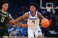
Mar 21, 2025; Seattle, WA, USA; Memphis Tigers guard PJ Haggerty (4) drives the ball during the second half against Colorado State Rams at Climate Pledge Arena. Mandatory Credit: Steven Bisig-Imagn Images

Memphis guard PJ Haggerty, a consensus second-team All-American, will enter the transfer portal. Haggerty told The Athletic of his plans Thursday, confirming several other media reports. Haggerty won American Athletic Conference Player of the Year honors after averaging a league-high 21.7 po…

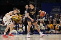
Mar 27, 2025; San Francisco, CA, USA; Texas Tech Red Raiders guard Kevin Overton (1) runs downcourt during the first half against the Arkansas Razorbacks during a West Regional semifinal of the 2025 NCAA tournament at Chase Center. Mandatory Credit: Eakin Howard-Imagn Images

Former Texas Tech guard Kevin Overton is transferring to Auburn, which will be his third team in three seasons. Overton acknowledged a report from On3.com on his Instagram page Thursday, with a photo indicating the move from the Red Raiders to the Tigers. Overton averaged 7.8 points and 3.7 …

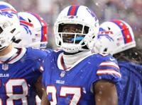
CB Tre'Davious White: Signed by Los Angeles Rams (previous team: Buffalo Bills)

The Buffalo Bills are reuniting with cornerback Tre'Davious White, who came to terms with his former team on a one-year deal worth up to $6.8 million, ESPN and NFL Network reported Thursday. White, 30, was the Bills' first-round draft pick in…

Mar 11, 2025; Charlotte, NC, USA; California Golden Bears guard Andrej Stojakovic (2) handles the ball defended by Virginia Tech Hokies guard Brandon Rechsteiner (7) during OT at Spectrum Center. Mandatory Credit: Jim Dedmon-Imagn Images

Cal guard Andrej Stojakovic is back in the transfer portal, his agent told multiple outlets on Thursday. Stojakovic -- the son of former Sacramento Kings All-Star Peja Stojakovic -- spent his freshman year at Stanford before transferring to B…

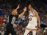
Apr 5, 2025; San Antonio, TX, USA; Auburn Tigers guard Chad Baker-Mazara (10) reacts against the Florida Gators in the semifinals of the men's Final Four of the 2025 NCAA Tournament at the Alamodome. Mandatory Credit: Robert Deutsch-Imagn Images

Auburn guard/forward Chad Baker-Mazara announced Thursday that he will enter the transfer portal and play his final year of college basketball elsewhere. Baker-Mazara spent two seasons at Auburn and was a key component on the Tigers' Final Fo…

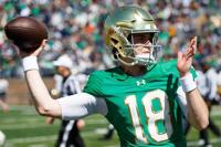
Notre Dame quarterback Steve Angeli during the Notre Dame Blue-Gold spring football game at Notre Dame Stadium on Saturday, April 12, 2025, in South Bend.

Steve Angeli, who was part of Notre Dame's quarterback competition this spring, is entering the transfer portal, several outlets reported Thursday. Angeli was up against CJ Carr and Kenny Minchey in a three-way battle this spring. As the back…

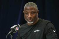
Feb 25, 2025; Indianapolis, IN, USA; New York Jets coach Aaron Glenn speaks during the NFL Scouting Combine at the Indiana Convention Center. Mandatory Credit: Kirby Lee-Imagn Images

Back with the Jets as a first-time head coach, Aaron Glenn understands the monumental task at hand. New York ended an inglorious two-year partnership with quarterback Aaron Rodgers that netted 12 wins in two seasons and signed Justin Fields a…

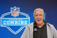
Pete Carroll turns 74 in September but nobody would know it by reading his energy. Carroll is back in coaching after a year away, taking over a Raiders' operation with 33 losses and three head coaches since 2022. Changes Carroll wanted implem…

Feb 25, 2025; Indianapolis, IN, USA; Las Vegas Raiders coach Pete Carroll speaks during the NFL Scouting Combine at the Indiana Convention Center. Mandatory Credit: Kirby Lee-Imagn Images

Jan 1, 2025; Pasadena, California, USA; Lee Corso on the ESPN Gameday set at Rose Bowl Stadium. Mandatory Credit: Kirby Lee-Imagn Images